
Thank you for supporting this site ❤️
Make a donation
Make a donation
Gear up for your next adventure:
As an Amazon Associate, this site earns from qualifying purchases at no extra cost to you.
Lhoka topographic map
Click on the map to display elevation.
Thank you for supporting this site ❤️
Make a donation
Make a donation
Gear up for your next adventure:
As an Amazon Associate, this site earns from qualifying purchases at no extra cost to you.
About this map
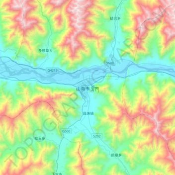
Name: Lhoka topographic map, elevation, terrain.
Location: Lhoka, Tsetang Township, Nêdong District, Lhoka, Tibet, China (29.07909 91.61057 29.39909 91.93057)
Average elevation: 4,148 m
Minimum elevation: 3,542 m
Maximum elevation: 5,430 m
Thank you for supporting this site ❤️
Make a donation
Make a donation
Gear up for your next adventure:
As an Amazon Associate, this site earns from qualifying purchases at no extra cost to you.