
As Pedrosas topographic map
Interactive map
Click on the map to display elevation.
About this map
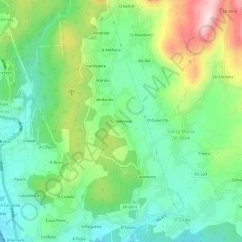
Name: As Pedrosas topographic map, elevation, terrain.
Location: As Pedrosas, Verducido, Pontevedra, Galicia, 36152, España (42.45302 -8.63576 42.49302 -8.59576)
Average elevation: 139 m
Minimum elevation: 4 m
Maximum elevation: 408 m
Other topographic maps
Click on a map to view its topography, its elevation and its terrain.