
Lamphey topographic map
Interactive map
Click on the map to display elevation.
About this map
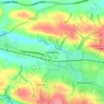
Name: Lamphey topographic map, elevation, terrain.
Location: Lamphey, Pembrokeshire, Wales, SA71 5NU, United Kingdom (51.65025 -4.89061 51.69025 -4.85061)
Average elevation: 39 m
Minimum elevation: 5 m
Maximum elevation: 86 m
Other topographic maps
Click on a map to view its topography, its elevation and its terrain.