
Choulou Village topographic map
Interactive map
Click on the map to display elevation.
About this map
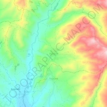
Name: Choulou Village topographic map, elevation, terrain.
Location: Choulou Village, Choulou, Paphos District, 8545, Cyprus (34.85190 32.53797 34.89190 32.57797)
Average elevation: 355 m
Minimum elevation: 217 m
Maximum elevation: 559 m
Choulou (Greek: Χούλου, Turkish: Hulu) is a village in the Paphos District of Cyprus, located 6 km (3.7 mi) west of Agios Fotios at an elevation of about 350 m (1,150 ft) above sea level. It is located in the centre of the district next to the village Lemona and near Statos-Agios Photios and Letymbou villages. Choulou is east of the Ezousa River and its tributary the Chalaras.