
Fonds de Leffe topographic map
Interactive map
Click on the map to display elevation.
About this map
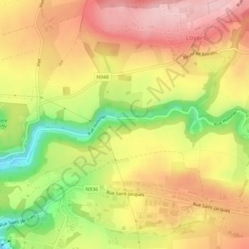
Name: Fonds de Leffe topographic map, elevation, terrain.
Location: Fonds de Leffe, Dinant, Namur, Wallonie, 5501, Belgique (50.26399 4.92381 50.28399 4.94381)
Average elevation: 212 m
Minimum elevation: 99 m
Maximum elevation: 294 m
Other topographic maps
Click on a map to view its topography, its elevation and its terrain.