
Lac Vert topographic map
Interactive map
Click on the map to display elevation.
About this map
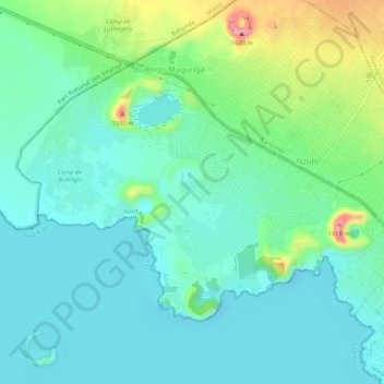
Name: Lac Vert topographic map, elevation, terrain.
Location: Lac Vert, Goma, Nord-Kivu, République démocratique du Congo (-1.64280 29.11525 -1.60706 29.16872)
Average elevation: 1,496 m
Minimum elevation: 1,452 m
Maximum elevation: 1,636 m
Other topographic maps
Click on a map to view its topography, its elevation and its terrain.
Goma
République démocratique du Congo > Nord-Kivu > Goma
Goma, Karisimbi, Goma, Nord-Kivu, 841, République démocratique du Congo
Average elevation: 1,740 m