
Cabo de San Vicente topographic map
Interactive map
Click on the map to display elevation.
About this map
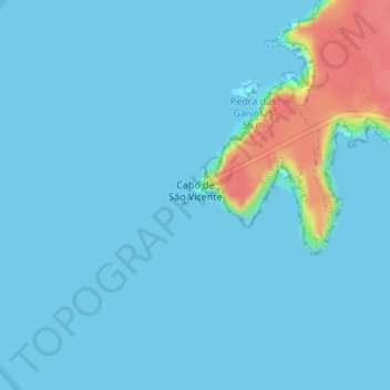
Name: Cabo de San Vicente topographic map, elevation, terrain.
Location: Cabo de San Vicente, Sagres, Vila do Bispo, Faro, Portugal (37.01262 -9.00661 37.03262 -8.98661)
Average elevation: 8 m
Minimum elevation: 0 m
Maximum elevation: 64 m