Geolocate

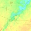
Wakeman topographic map

Click on the map to display elevation.

About this map

Name: Wakeman topographic map, elevation, terrain.

Location: Wakeman, Wakeman Township, Huron County, Ohio, 44889, United States (41.24751 -82.41239 41.26058 -82.38971)

Average elevation: 263 m

Minimum elevation: 241 m

Maximum elevation: 273 m

Other topographic maps

Click on a map to view its topography, its elevation and its terrain.
Celeryville

United States > Ohio > Huron County

Average elevation: 286 m

Clarksfield

United States > Ohio > Huron County

Average elevation: 275 m

Havana

United States > Ohio > Huron County

Average elevation: 253 m

East Norwalk

United States > Ohio > Huron County

Average elevation: 225 m

Peru

United States > Ohio > Huron County

Average elevation: 247 m

Gear up for your next adventure:

🧤Hiking Gloves - Protective gloves for outdoor use
👟Lightweight Trail Runners - Agile footwear for fast movement over rugged Australian terrain
🎨Portable Watercolor Kits - Paint the landscapes and topographic views you discover
📦Crushproof Equipment Cases - Safe transport for sensitive surveying and mapping instruments
🧢Wide Brim Sun Hats - Maximum coverage for the face and neck while out in the open

As an Amazon Associate, this site earns from qualifying purchases at no extra cost to you.