
Samara topographic map
Interactive map
Click on the map to display elevation.
About this map
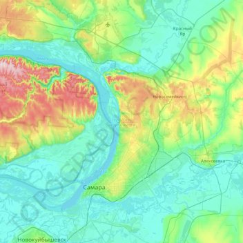
Name: Samara topographic map, elevation, terrain.
Location: Samara, Oblast de Samara, District fédéral de la Volga, Russie (53.09167 49.74541 53.55074 50.39039)
Average elevation: 99 m
Minimum elevation: 24 m
Maximum elevation: 374 m
Other topographic maps
Click on a map to view its topography, its elevation and its terrain.
Ленинский район
Russie > Oblast de Samara > Samara
Ленинский район, Samara, городской округ Самара, Oblast de Samara, District fédéral de la Volga, 443028, Russie
Average elevation: 51 m