Geolocate

Cublington topographic map

Click on the map to display elevation.

About this map

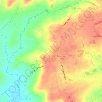
Name: Cublington topographic map, elevation, terrain.

Location: Cublington, Buckinghamshire, England, United Kingdom (51.88122 -0.80253 51.90613 -0.75768)

Average elevation: 122 m

Minimum elevation: 91 m

Maximum elevation: 144 m

Gear up for your next adventure:

🦘Outback Survival Gear - Essential gear for Australian outback
🦯Adjustable Trekking Poles - Reduce impact on knees when descending steep topographic ridges
🔦Headlamps - Hands-free lighting for hiking
🎨Portable Watercolor Kits - Paint the landscapes and topographic views you discover
🏕️Camping Gear - Essential camping equipment

As an Amazon Associate, this site earns from qualifying purchases at no extra cost to you.