
Buraydah topographic map
Interactive map
Click on the map to display elevation.
About this map
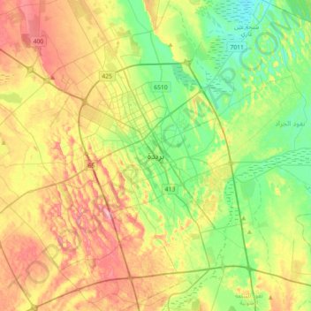
Name: Buraydah topographic map, elevation, terrain.
Location: Buraydah, محافظة بريدة, Provinz al-Qasim, 52354, Saudi-Arabien (26.17167 43.81167 26.49167 44.13167)
Average elevation: 628 m
Minimum elevation: 578 m
Maximum elevation: 699 m
Other topographic maps
Click on a map to view its topography, its elevation and its terrain.
Al Mulayda
Saudi-Arabien > Provinz al-Qasim
Al Mulayda, محافظة بريدة, Provinz al-Qasim, Saudi-Arabien
Average elevation: 646 m