
Gorra topographic map
Interactive map
Click on the map to display elevation.
About this map
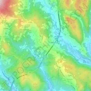
Name: Gorra topographic map, elevation, terrain.
Location: Gorra, Finale Ligure, Savona, Liguria, 17022, Italia (44.16318 8.27722 44.20318 8.31722)
Average elevation: 180 m
Minimum elevation: 11 m
Maximum elevation: 520 m