
Quindío topographic map
Interactive map
Click on the map to display elevation.
About this map
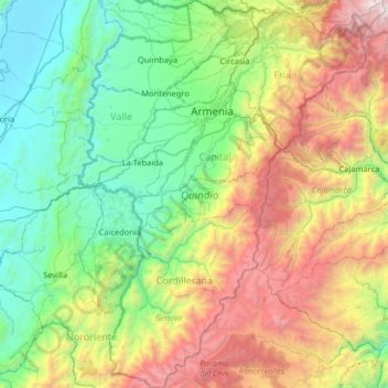
Name: Quindío topographic map, elevation, terrain.
Location: Quindío, Colombia (4.07392 -75.89562 4.72143 -75.38361)
Average elevation: 2,079 m
Minimum elevation: 899 m
Maximum elevation: 4,762 m
Other topographic maps
Click on a map to view its topography, its elevation and its terrain.