
Thank you for supporting this site ❤️
Make a donation
Make a donation
Gear up for your next adventure:
As an Amazon Associate, this site earns from qualifying purchases at no extra cost to you.
Orag topographic map
Click on the map to display elevation.
Thank you for supporting this site ❤️
Make a donation
Make a donation
Gear up for your next adventure:
As an Amazon Associate, this site earns from qualifying purchases at no extra cost to you.
About this map
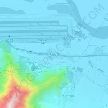
Name: Orag topographic map, elevation, terrain.
Location: Orag, Gyazhugling town, Gonggar County, Lhoka, Tibet, China (29.26968 90.90701 29.30968 90.94701)
Average elevation: 3,622 m
Minimum elevation: 3,564 m
Maximum elevation: 4,108 m
Thank you for supporting this site ❤️
Make a donation
Make a donation
Gear up for your next adventure:
As an Amazon Associate, this site earns from qualifying purchases at no extra cost to you.