Geolocate

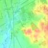
Cleburne topographic map

Click on the map to display elevation.

About this map

Name: Cleburne topographic map, elevation, terrain.

Location: Cleburne, Johnson County, Texas, United States (32.27795 -97.54567 32.44740 -97.34621)

Average elevation: 254 m

Minimum elevation: 208 m

Maximum elevation: 297 m

Other topographic maps

Click on a map to view its topography, its elevation and its terrain.
Turkey Peak

United States > Texas > Johnson County > Burleson

Average elevation: 237 m

Highland

United States > Texas > Johnson County

Average elevation: 198 m

Oak Hill

United States > Texas > Johnson County > Cleburne

Average elevation: 240 m

Gear up for your next adventure:

🔪Outdoor Multi-tools - Versatile tools for gear repair and survival tasks in the wilderness
🧦Merino Wool Hiking Socks - Moisture-wicking socks to prevent blisters during long topographic surveys
🎽Hiking Clothing - Breathable clothing for hiking
🧺Fast-Dry Microfiber Towels - Large towels that pack down to the size of an orange
🧭Military Style Lensatic Compass - Durable sighting compasses for advanced land navigation and surveying

As an Amazon Associate, this site earns from qualifying purchases at no extra cost to you.