Geolocate

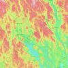
Sunne topographic map

Click on the map to display elevation.

About this map

Name: Sunne topographic map, elevation, terrain.

Location: Sunne, Sunne kommun, Värmland County, 686 31, Sweden (59.80018 13.09548 59.88018 13.17548)

Average elevation: 110 m

Minimum elevation: 58 m

Maximum elevation: 276 m

Other topographic maps

Click on a map to view its topography, its elevation and its terrain.

Årjängs kommun

Sweden > Värmland County

Average elevation: 168 m

Hammarö kommun

Sweden > Värmland County

Average elevation: 45 m

Arvika kommun

Sweden > Värmland County

Average elevation: 182 m

Glaskogen

Sweden > Värmland County

Average elevation: 194 m

Hammarö kommun

Sweden > Värmland County

Average elevation: 45 m

Torsby kommun

Sweden > Värmland County

Average elevation: 356 m

Säffle kommun

Sweden > Värmland County

Average elevation: 89 m

Kils kommun

Sweden > Värmland County

Average elevation: 104 m

Hagfors kommun

Sweden > Värmland County

Average elevation: 257 m

Filipstads kommun

Sweden > Värmland County

Average elevation: 241 m

Hammarö kommun

Sweden > Värmland County

Average elevation: 45 m

Storfors kommun

Sweden > Värmland County

Average elevation: 158 m

Pottern

Sweden > Värmland County

Average elevation: 145 m

Karlstads kommun

Sweden > Värmland County

Average elevation: 109 m

Sunne kommun

Sweden > Värmland County

Average elevation: 194 m

Gear up for your next adventure:

🌧️Rain Jackets - Waterproof jackets for hiking
🏕️Camping Gear - Essential camping equipment
🏃Compression Recovery Socks - Reduce leg fatigue after heavy days of elevation gain
🕯️Emergency Whistles - Safety whistles for hiking
🧴SPF 50+ Bulk Sunscreen - Maximum protection for long-term outdoor exposure

As an Amazon Associate, this site earns from qualifying purchases at no extra cost to you.