Geolocate

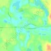
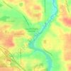
Walker topographic map

Click on the map to display elevation.

About this map
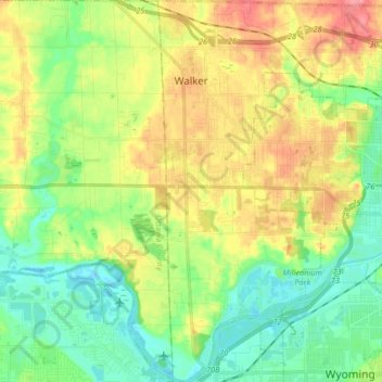
Name: Walker topographic map, elevation, terrain.

Location: Walker, Kent County, Michigan, United States (42.91066 -85.78859 43.03088 -85.66062)

Average elevation: 209 m

Minimum elevation: 177 m

Maximum elevation: 258 m

Other topographic maps

Click on a map to view its topography, its elevation and its terrain.
Harvard Lake

United States > Michigan > Kent County > Harvard

Average elevation: 267 m

Grattan

United States > Michigan > Kent County

Average elevation: 261 m

Ada

United States > Michigan > Kent County

Average elevation: 208 m

Kettle Lake

United States > Michigan > Kent County

Average elevation: 239 m

Cascade

United States > Michigan > Kent County

Average elevation: 222 m

Ada

United States > Michigan > Kent County

Average elevation: 208 m

Cobb Lake

United States > Michigan > Kent County > Bowne Township

Average elevation: 252 m

Grattan

United States > Michigan > Kent County > Grattan Township

Average elevation: 261 m

Parnell

United States > Michigan > Kent County > Grattan Township

Average elevation: 259 m

Gear up for your next adventure:

🎒Dry Bags - Waterproof bags for outdoor gear
🔋Rechargeable Batteries - Eco-friendly power for high-drain GPS units and flashlights
🥶Thermal Beanies - Warm hats for cold hikes
🧦Hiking Socks - Comfortable socks for long hikes
🔦Powerful LED Headlamps - Hands-free lighting for night navigation and setting up camp after dark

As an Amazon Associate, this site earns from qualifying purchases at no extra cost to you.