
Thank you for supporting this site ❤️
Make a donation
Make a donation
Gear up for your next adventure:
As an Amazon Associate, this site earns from qualifying purchases at no extra cost to you.
Grand-Marchin topographic map
Click on the map to display elevation.
Thank you for supporting this site ❤️
Make a donation
Make a donation
Gear up for your next adventure:
As an Amazon Associate, this site earns from qualifying purchases at no extra cost to you.
About this map
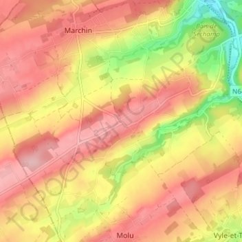
Name: Grand-Marchin topographic map, elevation, terrain.
Location: Grand-Marchin, Marchin, Huy, Liège, Wallonia, 4570, Belgium (50.44515 5.21747 50.48515 5.25747)
Average elevation: 225 m
Minimum elevation: 131 m
Maximum elevation: 281 m
Thank you for supporting this site ❤️
Make a donation
Make a donation
Gear up for your next adventure:
🐍Australian Snake Bite Kits - Specific pressure immobilization bandages for Australian venomous snakes
As an Amazon Associate, this site earns from qualifying purchases at no extra cost to you.