
Benther Berg topographic map
Interactive map
Click on the map to display elevation.
About this map
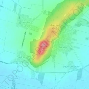
Name: Benther Berg topographic map, elevation, terrain.
Average elevation: 85 m
Minimum elevation: 60 m
Maximum elevation: 168 m
Other topographic maps
Click on a map to view its topography, its elevation and its terrain.
Everloh
Deutschland > Niedersachsen > Region Hannover > Gehrden
Everloh, Gehrden, Region Hannover, Niedersachsen, 30989, Deutschland
Average elevation: 75 m
Leveste
Deutschland > Niedersachsen > Region Hannover > Gehrden > Leveste
Leveste, Gehrden, Region Hannover, Niedersachsen, 30989, Deutschland
Average elevation: 68 m