Geolocate

Chelford topographic map

Click on the map to display elevation.

About this map

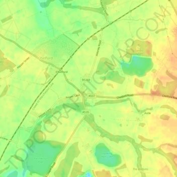
Name: Chelford topographic map, elevation, terrain.

Location: Chelford, Cheshire East, England, United Kingdom (53.25349 -2.29673 53.27984 -2.24253)

Average elevation: 78 m

Minimum elevation: 57 m

Maximum elevation: 90 m

Gear up for your next adventure:

🕯️Emergency Whistles - Safety whistles for hiking
🧴SPF 50+ Bulk Sunscreen - Maximum protection for long-term outdoor exposure
🔋Solar Power Banks - Solar chargers for outdoors
🏕️Camping Gear - Essential camping equipment
🔥Windproof Plasma Lighters - USB rechargeable lighters that work in high-altitude winds

As an Amazon Associate, this site earns from qualifying purchases at no extra cost to you.