
Borșa topographic map
Interactive map
Click on the map to display elevation.
About this map
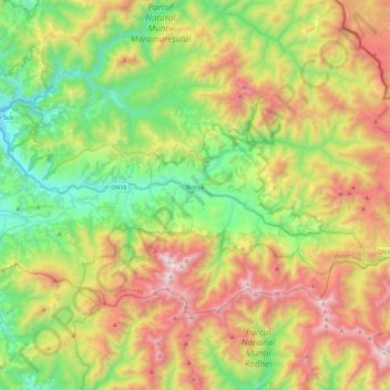
Name: Borșa topographic map, elevation, terrain.
Location: Borșa, Maramureș, Romania (47.56665 24.60433 47.73075 25.05644)
Average elevation: 1,163 m
Minimum elevation: 491 m
Maximum elevation: 2,265 m
Other topographic maps
Click on a map to view its topography, its elevation and its terrain.