Geolocate

Chamestan topographic map

Click on the map to display elevation.

About this map
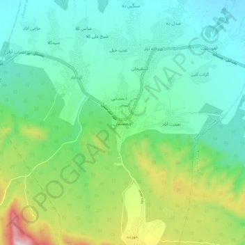
Name: Chamestan topographic map, elevation, terrain.

Location: Chamestan, دهستان ناتل رستاق, بخش چمستان, Nur County, Mazandaran Province, Iran (36.43738 52.07673 36.51738 52.15673)

Average elevation: 135 m

Minimum elevation: 10 m

Maximum elevation: 481 m

Other topographic maps

Click on a map to view its topography, its elevation and its terrain.

Gear up for your next adventure:

🔋Solar Power Banks - Solar chargers for outdoors
🎒Daypacks - Compact backpacks for short hikes
🔦Powerful LED Headlamps - Hands-free lighting for night navigation and setting up camp after dark
🕶️Polarized Outdoor Sunglasses - Reduce glare from rocks and water for better visual navigation
📍Handheld GPS - GPS devices for hiking and navigation

As an Amazon Associate, this site earns from qualifying purchases at no extra cost to you.