
芳苑鄉 topographic map
Interactive map
Click on the map to display elevation.
About this map
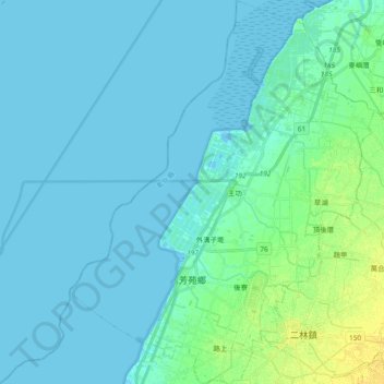
Name: 芳苑鄉 topographic map, elevation, terrain.
Location: 芳苑鄉, Comté de Changhua, Province de Taïwan, Taïwan (23.87728 120.26065 24.04789 120.40883)
Average elevation: 4 m
Minimum elevation: -2 m
Maximum elevation: 19 m
Other topographic maps
Click on a map to view its topography, its elevation and its terrain.
二林鎮
Taïwan > Province de Taïwan > Comté de Changhua
二林鎮, Comté de Changhua, Province de Taïwan, Taïwan
Average elevation: 10 m