
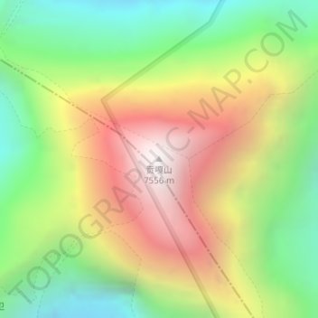
Mount Gongga topographic map
Interactive map
Click on the map to display elevation.
About this map
Name: Mount Gongga topographic map, elevation, terrain.
Average elevation: 6,496 m
Minimum elevation: 5,699 m
Maximum elevation: 7,468 m
Mount Gongga (simplified Chinese: 贡嘎山; traditional Chinese: 貢嘎山; pinyin: Gònggá Shān), also known as Minya Konka (Khams Tibetan pinyin: Mi'nyâg Gong'ga Riwo) and colloquially as "The King of Sichuan Mountains", is the highest mountain in Sichuan province, China. It has an elevation of 7,556 m (24,790 ft) above sea level. This makes it the third highest peak in the world outside of the Himalaya/Karakoram range, after Tirich Mir and Kongur Tagh, and the easternmost 7,000-metre (23,000 ft) peak in the world. It is situated in the Daxue Shan mountain range, between Dadu River and Yalong River, and is part of the Hengduan mountainous region. From it comes the Hailuogou glacier.