
La Porte topographic map
Interactive map
Click on the map to display elevation.
About this map
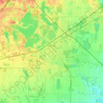
Name: La Porte topographic map, elevation, terrain.
Location: La Porte, LaPorte County, Indiana, 46350, United States (41.56075 -86.76490 41.63925 -86.67352)
Average elevation: 246 m
Minimum elevation: 227 m
Maximum elevation: 270 m
Other topographic maps
Click on a map to view its topography, its elevation and its terrain.
Fish Creek
United States > Indiana > LaPorte County > Fish Lake
Fish Creek, Fish Lake, LaPorte County, Indiana, United States
Average elevation: 217 m