
Thank you for supporting this site ❤️
Make a donation
Make a donation
Gear up for your next adventure:
As an Amazon Associate, this site earns from qualifying purchases at no extra cost to you.
Mismi topographic map
Click on the map to display elevation.
Thank you for supporting this site ❤️
Make a donation
Make a donation
Gear up for your next adventure:
As an Amazon Associate, this site earns from qualifying purchases at no extra cost to you.
About this map
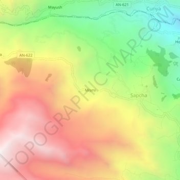
Name: Mismi topographic map, elevation, terrain.
Location: Mismi, Sapcha, Acochaca, Province of Asunción, Ancash, Peru (-9.09432 -77.42162 -9.05432 -77.38162)
Average elevation: 3,596 m
Minimum elevation: 2,841 m
Maximum elevation: 4,313 m
Thank you for supporting this site ❤️
Make a donation
Make a donation
Gear up for your next adventure:
As an Amazon Associate, this site earns from qualifying purchases at no extra cost to you.