
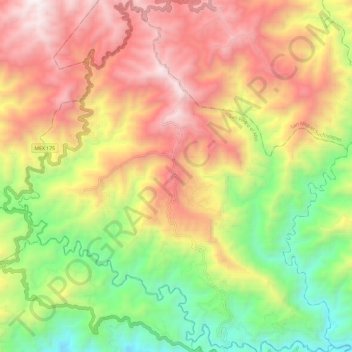
San Pedro el Alto topographic map
Interactive map
Click on the map to display elevation.
About this map
Name: San Pedro el Alto topographic map, elevation, terrain.
Location: San Pedro el Alto, Oaxaca, Mexico (15.96603 -96.52729 16.07981 -96.41645)
Average elevation: 1,716 m
Minimum elevation: 843 m
Maximum elevation: 2,620 m
Other topographic maps
Click on a map to view its topography, its elevation and its terrain.
Sierra Madre del Sur
Sierra Madre del Sur, San Juan Ozolotepec, Oaxaca, Mexico
Average elevation: 3,150 m
Pueblo Viejo
Mexico > Oaxaca > Pueblo Viejo
Pueblo Viejo, Magdalena Peñasco, Oaxaca, Mexico
Average elevation: 2,284 m