
Lautoka topographic map
Interactive map
Click on the map to display elevation.
About this map
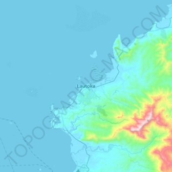
Name: Lautoka topographic map, elevation, terrain.
Location: Lautoka, Western, Fiji (-17.76440 177.29301 -17.44440 177.61301)
Average elevation: 88 m
Minimum elevation: 0 m
Maximum elevation: 1,158 m