
Muğla topographic map
Interactive map
Click on the map to display elevation.
About this map
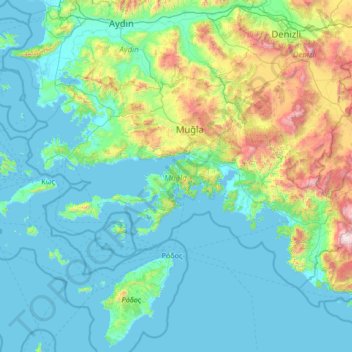
Name: Muğla topographic map, elevation, terrain.
Location: Muğla, Aegean Region, Turkey (36.14900 27.14286 37.60069 29.77176)
Average elevation: 339 m
Minimum elevation: -3 m
Maximum elevation: 2,937 m