
Nogueruelas topographic map
Interactive map
Click on the map to display elevation.
About this map
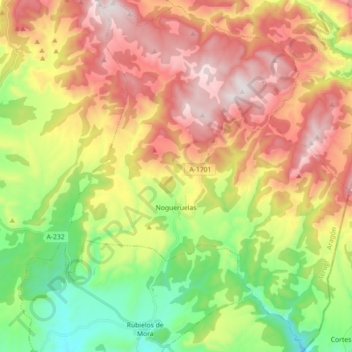
Name: Nogueruelas topographic map, elevation, terrain.
Location: Nogueruelas, Gúdar-Javalambre, Teruel, Aragón, España (40.18147 -0.69320 40.31810 -0.54790)
Average elevation: 1,299 m
Minimum elevation: 857 m
Maximum elevation: 1,800 m