
Ternell topographic map
Interactive map
Click on the map to display elevation.
About this map
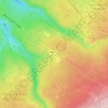
Name: Ternell topographic map, elevation, terrain.
Location: Ternell, Eupen, Verviers, Luik, Wallonië, België (50.56581 6.10996 50.60581 6.14996)
Average elevation: 497 m
Minimum elevation: 371 m
Maximum elevation: 620 m
Other topographic maps
Click on a map to view its topography, its elevation and its terrain.