
Ostende topographic map
Interactive map
Click on the map to display elevation.
About this map
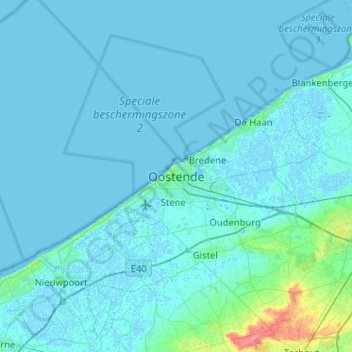
Name: Ostende topographic map, elevation, terrain.
Location: Ostende, Flandre-Occidentale, Flandre, 8400, Belgique (51.06586 2.75950 51.38586 3.07950)
Average elevation: 3 m
Minimum elevation: -3 m
Maximum elevation: 50 m
Other topographic maps
Click on a map to view its topography, its elevation and its terrain.