
Garagoa topographic map
Interactive map
Click on the map to display elevation.
About this map
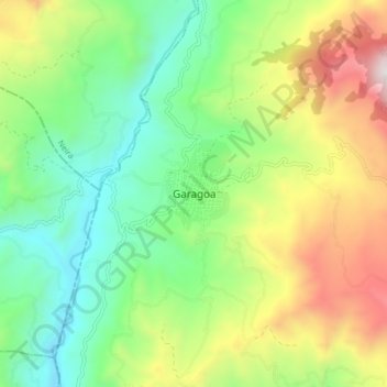
Name: Garagoa topographic map, elevation, terrain.
Location: Garagoa, Neira, Boyacá, 152860, Colômbia (5.04222 -73.40431 5.12222 -73.32431)
Average elevation: 1,786 m
Minimum elevation: 1,286 m
Maximum elevation: 2,667 m