Geolocate

Murchison topographic map

Click on the map to display elevation.

About this map

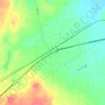
Name: Murchison topographic map, elevation, terrain.

Location: Murchison, Texas, United States (32.25848 -95.76969 32.29848 -95.72969)

Average elevation: 144 m

Minimum elevation: 118 m

Maximum elevation: 181 m

Gear up for your next adventure:

📡Satellite Messengers - Emergency communication devices
🚴Bike GPS - GPS devices for cycling
🧢Outdoor Sun Hats - Sun protection hats for hiking
🦟Heavy Duty Insect Repellent - Essential protection against flies, mozzies, and march flies
🎧Bluetooth Outdoor Earbuds - Listen to navigation cues or podcasts during long solo treks

As an Amazon Associate, this site earns from qualifying purchases at no extra cost to you.