
Thank you for supporting this site ❤️
Make a donation
Make a donation
Gear up for your next adventure:
As an Amazon Associate, this site earns from qualifying purchases at no extra cost to you.
Cansas topographic map
Click on the map to display elevation.
Thank you for supporting this site ❤️
Make a donation
Make a donation
Gear up for your next adventure:
As an Amazon Associate, this site earns from qualifying purchases at no extra cost to you.
About this map
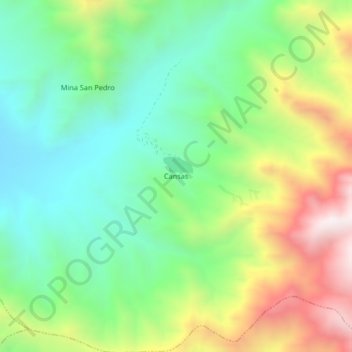
Name: Cansas topographic map, elevation, terrain.
Location: Cansas, Yauca del Rosario, Province of Ica, Ica, Peru (-14.03980 -75.60958 -13.99980 -75.56958)
Average elevation: 1,183 m
Minimum elevation: 819 m
Maximum elevation: 1,827 m
Thank you for supporting this site ❤️
Make a donation
Make a donation
Gear up for your next adventure:
As an Amazon Associate, this site earns from qualifying purchases at no extra cost to you.