Geolocate

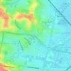
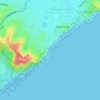
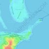
Islington topographic map

Click on the map to display elevation.

About this map

Name: Islington topographic map, elevation, terrain.

Location: Islington, Newcastle, Newcastle-Maitland, New South Wales, 2296, Australia (-32.92091 151.73744 -32.90817 151.75397)

Average elevation: 6 m

Minimum elevation: -3 m

Maximum elevation: 12 m

New South Wales trails, hiking, mountain biking, running and outdoor activities

Other topographic maps

Click on a map to view its topography, its elevation and its terrain.
Jesmond Park

Australia > New South Wales > Newcastle

Average elevation: 35 m

Cameron Park

Australia > New South Wales > Newcastle

Average elevation: 23 m

Glenrock Lagoon

Australia > New South Wales > Newcastle

Average elevation: 39 m

Nobbys Beach

Australia > New South Wales > Newcastle

Average elevation: 3 m

Redhead Bluff

Australia > New South Wales > Newcastle

Average elevation: 13 m

Dixon Park

Australia > New South Wales > Newcastle

Average elevation: 12 m

Gear up for your next adventure:

🧼Biodegradable Outdoor Soap - Clean gear and yourself without harming the local ecosystem
👄SPF Lip Balm - Prevent sun and wind-burnt lips on mountain ridges
🩹Blister Prevention Tape - Apply to friction points before they become painful sores
🧼Clip-on Hand Sanitizer - Maintain hygiene when water for washing is scarce
💧Personal Water Filters - Drink safely from streams and lakes identified on your map

As an Amazon Associate, this site earns from qualifying purchases at no extra cost to you.