Geolocate

Dunlop topographic map

Click on the map to display elevation.

About this map

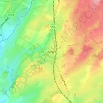
Name: Dunlop topographic map, elevation, terrain.

Location: Dunlop, East Ayrshire, Scotland, KA3 4AF, United Kingdom (55.69224 -4.55584 55.73224 -4.51584)

Average elevation: 132 m

Minimum elevation: 78 m

Maximum elevation: 191 m

Gear up for your next adventure:

🧦Hiking Socks - Comfortable socks for long hikes
🆘Personal Locator Beacons (PLB) - Satellite emergency beacons for life-saving help in areas with no mobile coverage
Altimeter Barometer Watches - Outdoor watches with built-in sensors to track altitude changes and weather shifts
🧴SPF 50+ Bulk Sunscreen - Maximum protection for long-term outdoor exposure
🦯Trekking Poles - Walking poles for hiking stability

As an Amazon Associate, this site earns from qualifying purchases at no extra cost to you.