
Churchill topographic map
Interactive map
Click on the map to display elevation.
About this map
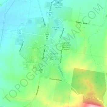
Name: Churchill topographic map, elevation, terrain.
Location: Churchill, Latrobe City, Victoria, 3842, Australia (-38.33481 146.40403 -38.29481 146.44403)
Average elevation: 129 m
Minimum elevation: 81 m
Maximum elevation: 244 m
Other topographic maps
Click on a map to view its topography, its elevation and its terrain.
Morwell National Park
Australia > Victoria > Churchill
Morwell National Park, Fay Street, Jeeralang Junction, Churchill, Latrobe City, Gippsland, Victoria, Australia
Average elevation: 211 m