Geolocate

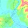
Starr topographic map

Click on the map to display elevation.

About this map

Name: Starr topographic map, elevation, terrain.

Location: Starr, Starr Township, Hocking County, Ohio, 45654, United States (39.37701 -82.38099 39.41701 -82.34099)

Average elevation: 273 m

Minimum elevation: 224 m

Maximum elevation: 314 m

Other topographic maps

Click on a map to view its topography, its elevation and its terrain.
Laurelville

United States > Ohio > Hocking County

Average elevation: 249 m

Falls Township

United States > Ohio > Hocking County

Average elevation: 267 m

Perry Township

United States > Ohio > Hocking County

Average elevation: 296 m

Benton Township

United States > Ohio > Hocking County

Average elevation: 289 m

Hideaway Hills

United States > Ohio > Hocking County

Average elevation: 278 m

Starr Township

United States > Ohio > Hocking County

Average elevation: 277 m

Logan

United States > Ohio > Hocking County

Average elevation: 254 m

Laurelville

United States > Ohio > Hocking County

Average elevation: 249 m

Benton Township

United States > Ohio > Hocking County

Average elevation: 289 m

Hideaway Hills

United States > Ohio > Hocking County

Average elevation: 278 m

Gear up for your next adventure:

🆘Personal Locator Beacons (PLB) - Satellite emergency beacons for life-saving help in areas with no mobile coverage
🚴Cycling Backpacks - Backpacks for cyclists
🦶Orthotic Hiking Insoles - Extra arch support for long-distance topographic treks
📡Satellite Messengers - Emergency communication devices
⛺Lightweight Tents - Compact tents for backpacking

As an Amazon Associate, this site earns from qualifying purchases at no extra cost to you.