
Hatzfeld topographic map
Interactive map
Click on the map to display elevation.
About this map
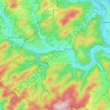
Name: Hatzfeld topographic map, elevation, terrain.
Average elevation: 451 m
Minimum elevation: 313 m
Maximum elevation: 672 m
Other topographic maps
Click on a map to view its topography, its elevation and its terrain.
Holzhausen
Deutschland > Hessen > Hatzfeld > Holzhausen
Holzhausen, Hatzfeld, Landkreis Waldeck-Frankenberg, Hessen, 35088, Deutschland
Average elevation: 414 m