

Pocatello topographic map
Click on the map to display elevation.
Pocatello
Pocatello is the fifth-largest city in the state, just behind Idaho Falls. In 2007, Pocatello was ranked twentieth on Forbes list of Best Small Places for Business and Careers. Pocatello is the home of Idaho State University and the manufacturing facility of ON Semiconductor. The city is at an elevation of 4,462 feet (1,360 m) above sea level and is served by the Pocatello Regional Airport.
About this map
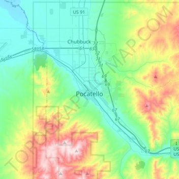
Name: Pocatello topographic map, elevation, terrain.
Location: Pocatello, Bannock County, Idaho, United States (42.80215 -112.63186 42.93149 -112.36026)
Average elevation: 1,580 m
Minimum elevation: 1,328 m
Maximum elevation: 2,209 m