
Mansonville topographic map
Interactive map
Click on the map to display elevation.
About this map
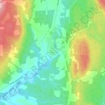
Name: Mansonville topographic map, elevation, terrain.
Location: Mansonville, Memphrémagog, Estrie, Québec, J0E 1X0, Canada (45.03026 -72.41046 45.07026 -72.37046)
Average elevation: 211 m
Minimum elevation: 151 m
Maximum elevation: 303 m
Other topographic maps
Click on a map to view its topography, its elevation and its terrain.
Mansonville
Canada > Québec > Mansonville
Mansonville, Memphrémagog, Estrie, Québec, Canada
Average elevation: 211 m