
Sankt Veit an der Glan topographic map
Interactive map
Click on the map to display elevation.
About this map
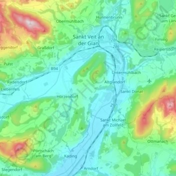
Name: Sankt Veit an der Glan topographic map, elevation, terrain.
Average elevation: 591 m
Minimum elevation: 450 m
Maximum elevation: 1,116 m
Other topographic maps
Click on a map to view its topography, its elevation and its terrain.
Hochosterwitz
Autriche > Carinthie > Bezirk Sankt Veit an der Glan > Sankt Georgen am Längsee
Average elevation: 628 m