Geolocate

St. Johann topographic map

Interactive map

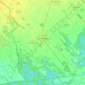
Click on the map to display elevation.

About this map

Name: St. Johann topographic map, elevation, terrain.

Location: St. Johann, Mosonmagyaróvári járás, Komitat Győr-Moson-Sopron, Westtransdanubien, Transdanubien, Ungarn (47.70777 17.05098 47.84846 17.28107)

Average elevation: 117 m

Minimum elevation: 108 m

Maximum elevation: 128 m

Other topographic maps

Click on a map to view its topography, its elevation and its terrain.

Heiligenstein

Ungarn > Komitat Győr-Moson-Sopron

Heiligenstein, Kreis Ödenburg, Komitat Győr-Moson-Sopron, Westtransdanubien, Transdanubien, 9437, Ungarn

Average elevation: 127 m

Raab

Ungarn > Komitat Győr-Moson-Sopron

Raab, Győri járás, Komitat Győr-Moson-Sopron, Westtransdanubien, Transdanubien, Ungarn

Average elevation: 120 m

Kóny

Ungarn > Komitat Győr-Moson-Sopron

Kóny, Csornai járás, Komitat Győr-Moson-Sopron, Westtransdanubien, Transdanubien, 9144, Ungarn

Average elevation: 114 m

Sankt Niklaus am Neusiedlersee

Ungarn > Komitat Győr-Moson-Sopron > Sankt Niklaus am Neusiedlersee

Sankt Niklaus am Neusiedlersee, Kreis Ödenburg, Komitat Győr-Moson-Sopron, Westtransdanubien, Transdanubien, 9444, Ungarn

Average elevation: 143 m

Frauendorf

Ungarn > Komitat Győr-Moson-Sopron

Frauendorf, Mosonmagyaróvári járás, Komitat Győr-Moson-Sopron, Westtransdanubien, Transdanubien, 9225, Ungarn

Average elevation: 124 m