
Chirapa topographic map
Interactive map
Click on the map to display elevation.
About this map
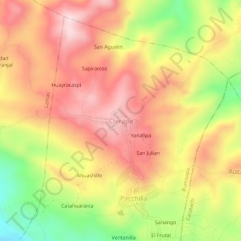
Name: Chirapa topographic map, elevation, terrain.
Location: Chirapa, Rumisapa, Lamas, San Martín, 22170, Pérou (-6.43113 -76.48148 -6.39113 -76.44148)
Average elevation: 783 m
Minimum elevation: 544 m
Maximum elevation: 954 m