Geolocate

Capual topographic map

Click on the map to display elevation.

About this map

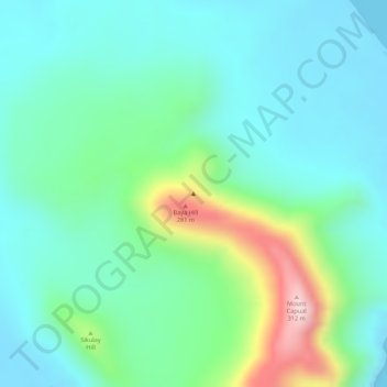
Name: Capual topographic map, elevation, terrain.

Location: Capual, Sulu, Bangsamoro, Philippines (6.03328 121.41662 6.03338 121.41672)

Average elevation: 81 m

Minimum elevation: 0 m

Maximum elevation: 304 m

Other topographic maps

Click on a map to view its topography, its elevation and its terrain.

Lugus Island

Philippines > Sulu

Average elevation: 20 m

Bambannan Island

Philippines > Sulu

Average elevation: 0 m

Dammi Island

Philippines > Sulu

Average elevation: 0 m

Lugus

Philippines > Sulu

Average elevation: 7 m

Siasi

Philippines > Sulu

Average elevation: 7 m

Seit Lake

Philippines > Sulu > Old Panamao

Average elevation: 14 m

North Ubian Island

Philippines > Sulu > Pangutaran

Average elevation: 2 m

Simisa Island

Philippines > Sulu > Banguingui

Average elevation: 2 m

Kulassian Island

Philippines > Sulu > Pangutaran

Average elevation: 0 m

Jolo Island

Philippines > Sulu

Average elevation: 28 m

Patikul

Philippines > Sulu

Average elevation: 50 m

Pangutaran

Philippines > Sulu

Average elevation: 4 m

Siasi Island

Philippines > Sulu > Siasi

Average elevation: 47 m

Siasi

Philippines > Sulu

Average elevation: 7 m

Gear up for your next adventure:

🪢550 Survival Paracord - Versatile cordage for gear repair and emergency lashing
💡Collapsible Camping Lanterns - Illuminate your base camp or tent for map studying at night
🏃Compression Recovery Socks - Reduce leg fatigue after heavy days of elevation gain
🚴Cycling Backpacks - Backpacks for cyclists
🎒Dry Bags - Waterproof bags for outdoor gear

As an Amazon Associate, this site earns from qualifying purchases at no extra cost to you.