
Lake Moore topographic map
Interactive map
Click on the map to display elevation.
About this map
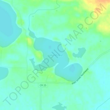
Name: Lake Moore topographic map, elevation, terrain.
Location: Lake Moore, Swift County, Minnesota, United States (45.37625 -95.55088 45.38939 -95.53189)
Average elevation: 324 m
Minimum elevation: 315 m
Maximum elevation: 346 m
Other topographic maps
Click on a map to view its topography, its elevation and its terrain.
Clontarf
United States > Minnesota > Swift County
Clontarf, Swift County, Minnesota, 56226, United States
Average elevation: 318 m