
Narvaez topographic map
Interactive map
Click on the map to display elevation.
About this map
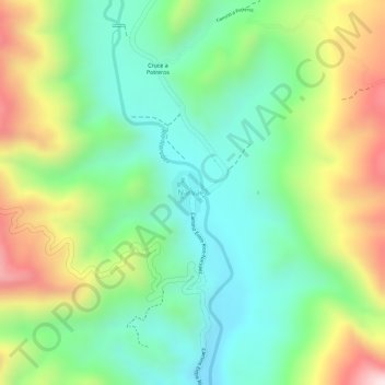
Name: Narvaez topographic map, elevation, terrain.
Average elevation: 1,833 m
Minimum elevation: 1,676 m
Maximum elevation: 2,078 m
Other topographic maps
Click on a map to view its topography, its elevation and its terrain.
Entre Ríos
Bolivia > Tarija > Provincia Burnet O'Connor > Municipio Entre Rios
Entre Ríos, Municipio Entre Rios, Provincia Burnet O'Connor, Tarija, Bolivia
Average elevation: 1,258 m