Geolocate

Pachad topographic map

Click on the map to display elevation.

About this map
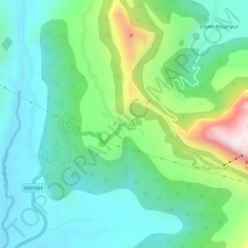
Name: Pachad topographic map, elevation, terrain.

Location: Pachad, Mahad, Raigad, Maharashtra, 402305, India (18.21656 73.40061 18.25656 73.44061)

Average elevation: 248 m

Minimum elevation: 27 m

Maximum elevation: 858 m

Other topographic maps

Click on a map to view its topography, its elevation and its terrain.
Raigad Fort

India > Maharashtra > Mahad > Hirkaniwadi

Average elevation: 450 m

Gear up for your next adventure:

🧴Sunscreen SPF - Sun protection for outdoor activities
🪢550 Survival Paracord - Versatile cordage for gear repair and emergency lashing
👟Lightweight Trail Runners - Agile footwear for fast movement over rugged Australian terrain
🔦Powerful LED Headlamps - Hands-free lighting for night navigation and setting up camp after dark
🧥Insulated Down Jackets - High warmth-to-weight ratio for cold nights in the high country

As an Amazon Associate, this site earns from qualifying purchases at no extra cost to you.