
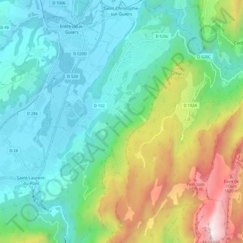
Saint-Christophe-sur-Guiers topographic map
Interactive map
Click on the map to display elevation.
About this map
Name: Saint-Christophe-sur-Guiers topographic map, elevation, terrain.
Average elevation: 820 m
Minimum elevation: 374 m
Maximum elevation: 2,024 m